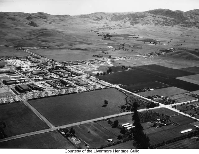
Livermore, 1936
Taken from the air towards the East North East.
Stanley Blvd comes in from the bottom left corner, and curves into First Street.
There are two sets of railroad tracks. One is about where the tracks are now, the other set is the old SP tracks that were moved in the 70s, and later abandoned.
Note that First Street takes a hard jog at Livermore Ave. The curve was put in later.
The flagpole can only be seen on an extreme closeup, but it is at its original location in this picture. It was moved 15-20 feet south in 1959.
East First Street takes the "Old First Street" path here. It now takes a turn at the SP (right most) tracks, replacing the tracks for a bit, before turning north to go over the WP tracks and reconnecting to the original path.
At the very top of the picture, 1st St. is on the left with Portola running into it from the left at a diagonal. Just beyond that point is the Coast Manufacturing Safety Fuse facility, which is now the Trevarno Road area. The manufacturing area itself is on the right side of the railroad tracks. That is now Hexcel Corporation. (Update: Hexcel is no longer there. Their buildings have been turn down and housing was built there around 2014 and 2015).
College Ave is on the right going diagonal to other streets.
The beginnings of Holmes is at the bottom middle. The triangle that is now Centennial Park can be seen as Homes breaks off from South S Street (which now does not connect to Holmes).